Shaktipeeth Expressway & Sindhudurg Land: 2028 Reality Check

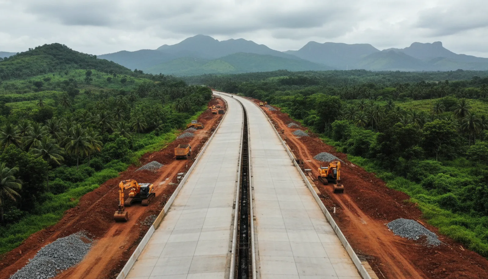
The Shaktipeeth Expressway is a planned 856 km, six-lane, access-controlled road from Digraj in Wardha district to Banda in Sawantwadi taluka, Sindhudurg, costed at roughly ₹1.01 lakh crore and expected to open in 2028–29. It is not the coastal road — that is Revas–Redi / MSH-4. For beach-plot buyers, the verdict: this expressway moves inland land, not beach-touch prices.
That verdict runs against most of the broker material circulating in Sindhudurg this year, so the rest of this post argues it with distances, precedents and dates. Where a number could not be verified against a dated source, we say so.
What the Corridor Actually Is
Shaktipeeth is MSRDC's second Samruddhi-template expressway — a Vidarbha-to-somewhere greenfield corridor on the same acquisition law. The "somewhere" is the Goa border, via the pilgrimage sites (Mahalakshmi, Tuljabhavani, Patradevi) that give the road its name.
| Item | Figure | Source (date) |
|---|---|---|
| Length | 856.765 km (revised from ~802 km) | Free Press Journal (4 Feb 2026) |
| Start / end | Digraj (Wardha) → Banda (Sawantwadi taluka, Sindhudurg) | Swarajya (14 Jun 2026) |
| Footprint | 13 districts, 40 talukas, 409 villages; ~8,500 ha to acquire | Swarajya (Jun 2026); FPJ (Feb 2026) |
| Cost | ₹1.01 lakh crore, up ₹15,000 crore from ₹86,000 crore after the realignment | FPJ (4 Feb 2026) |
| Land-acquisition budget | ₹20,787 crore, state cabinet approval June 2025 | Construction World |
| Realignment | Approved in early April 2026 after Kolhapur/Sangli farmer protests; 395 villages vs 350 on the old map | FPJ; Pune Pulse |
| Status | Final notification issued June 2026; joint land surveys to begin in 298 villages | Swarajya (14 Jun 2026) |
| Opening | 2028–29 (expected) | Wikipedia |
Two things matter more than the headline cost. The corridor's purpose is to pull Nagpur, Marathwada and Kolhapur towards Goa — a 21-hour drive compressed to about eight. And the road physically ends at Banda, where it meets NH-66. Patradevi, the Goa-side name in older documents, is the border check-post on NH-66 about 10 km further south; we found no notified Goa-side expressway segment in any 2026 source. Beyond Banda, Shaktipeeth traffic is on the same NH-66 everyone already uses.
Banda Is Not the Beach
Banda is a market town on the Terekhol river, 12 km south-east of Sawantwadi on the Sawantwadi–Goa road. It has no coastline. Every beach a Shaktipeeth buyer is being sold sits somewhere between 20 and 65 km further on, along roads the expressway does not touch.
| From the Banda terminus to | Approx. road distance | Road you use |
|---|---|---|
| Sawantwadi | 12 km | NH-66 north |
| Mopa (Manohar International) Airport | ~25 km | NH-66 south, then the Pernem–Mopa road |
| Shiroda / Velagar beach | ~20 km | District roads via Aronda |
| Vengurla | ~25 km | Sawantwadi–Vengurla road |
| Kondura beach | ~30 km | Vengurla coastal road |
| Kudal | ~35 km | NH-66 north |
| Malvan / Tarkarli | ~60–65 km | NH-66 to Kasal, then MSH-4 / district road |
Approximate driving distances; verify on a map for a specific plot. Distances from the terminus, not from the nearest interchange, which the alignment maps do not yet fix.
The last mile is the whole point. A Nagpur family driving eight hours down Shaktipeeth then spends another 60–90 minutes on the same two-lane district roads to Tarkarli that a Mumbai family uses today. The expressway does not shorten the coastal segment by a kilometre.
What it does is change who arrives. Its catchment is Vidarbha, Marathwada, Solapur and Kolhapur — inland Maharashtra's domestic-tourist volume, which currently defaults to Goa. That is a homestay-occupancy story for Vengurla and Tarkarli operators, and a real one. It is not a beach-plot price story, because those plots are already priced off the airport.
The Airport Already Did the Coastal Job
The Mopa aerocity thesis explains why: Manohar International Airport opened in January 2023, roughly 40–60 minutes from Shiroda and 60–90 minutes from Vengurla and Kondura by road, and coastal Sindhudurg's NA plot prices re-rated on it. Our Vengurla price guide tracks prime NA plots from ₹1.5–2.5L/guntha pre-2019 to ₹5–7L/guntha in 2026 — the airport-and-MSH-4 re-rating. In the language of our transportation multiples framework, the coast has already moved from the Agricultural Multiple to the Connectivity Multiple. A second catalyst that terminates 20–65 km short of the coast does not re-run that step; it adds tourist volume to an asset that already has its access premium baked in.
Inland Sindhudurg is a different balance sheet. Raw agricultural land three-plus kilometres from the coast asks ₹80,000–₹2.25L/guntha; road-touch NA plots 6–10 km inland ask ₹4–4.5L/guntha; Kudal, with rail access, ₹6–7L/guntha. Banda and Sawantwadi have no expressway premium in their prices yet, because there has been no expressway. That is where the Shaktipeeth multiple can actually apply.
What an Inland Terminus Does to Land, by Distance Band
The pattern is consistent across the corridors we cover:
- 0–5 km from the interchange: the sharpest re-rating and the most noise. Logistics, fuel and truck parking compete with residential. It is also where acquisition-line uncertainty hurts most — until the alignment is pegged on the ground, a plot can be inside the strip.
- 5–15 km: the residential and second-home sweet spot. Close enough that the interchange is a 15-minute drive, far enough that the road is not the view. Our Delhi–Dehradun expressway analysis tracked 15–25% appreciation projected (not registry-measured) over 18–24 months post-opening, after early pockets had already logged 20–30% — and the pockets that led were the ones a short drive off the corridor, not on it. On MSH-4, the same logic gave us the "2–5 km off the highway" entry rule.
- 30+ km: the effect is second-order — more visitors, not more buyers. Prices in this band move on their own drivers (beach, CRZ buildability, airport time), and the expressway is a rounding error.
Map that onto Sindhudurg. Banda and its immediate villages — Degve, Padve, Majgaon, Kegad — are the 0–5 km band. Sawantwadi and the Sawantwadi–Mopa corridor are 5–15 km. Vengurla, Shiroda and Kondura are 20–30 km. Malvan and Tarkarli are 60 km-plus. The beach belt sits where the expressway is a footnote.
For Samruddhi itself — the direct template — we could not find an independent, registry-based study of village land prices along the corridor. Developer material cites a 3.7x rise in premium parcels near Nagpur's Samruddhi circle from 2015 to 2024, but that is marketing data for a metro fringe, not evidence for a rural terminus. Treat Samruddhi's price story as unverified; its timeline story, below, is documented.
Where the Thesis Points, If It Holds
If Shaktipeeth is an inland story, the land it moves is inland too: NA plots in the 5–15 km band around Banda–Sawantwadi, or road-touch NA land on the Kudal side of NH-66 where expressway traffic enters the district's rail-and-highway spine.
| Option | Where the expressway helps | Where it does not |
|---|---|---|
| NA plot, Sawantwadi belt (₹7,000–9,500/sq yard in gated projects; cheaper on individual road-touch parcels) | Interchange within 15 min; Mopa within 30 min; domestic-tourist stopover demand | Not a coastal asset; rental demand is transit and pilgrimage, not beach |
| NA plot, Kudal (₹6–7L/guntha) | Rail + NH-66 + expressway traffic converge; district-town demand | Priced closer to the coast already; smaller expressway delta |
| Beach-touch NA, Vengurla/Kondura (₹5–7L/guntha) | Homestay occupancy from Vidarbha/Kolhapur visitors | Price already reflects Mopa + MSH-4; expressway adds volume, not a step change |
| Agricultural land near Banda (₹80,000–₹2.25L/guntha) | Cheapest exposure to the 0–5 km band | A non-farmer cannot legally buy it — see below |
The agricultural row is where most "Shaktipeeth plot" pitches land, so the two legal reminders bear repeating:
- Section 63 of the Maharashtra Tenancy and Agricultural Lands Act, 1948 bars a non-agriculturist from buying agricultural land in Maharashtra without the Collector's permission; the penalty on an invalid transfer is forfeiture to the state, not a fine. The exceptions are narrow and paper-based: Section 63-1A allows a non-agriculturist to buy land for a bona fide non-agricultural purpose, and land already zoned for non-agricultural use in a sanctioned regional or development plan can be sold to a non-agriculturist — which is exactly why the 7/12 and the zoning certificate, not the broker, decide whether a given Banda parcel is buyable. NRIs face the FEMA agricultural bar on top, with no exception.
- The MLRC (Second Amendment) Act, 2025 (assented 31 December 2025, GR dated 10 February 2026) removed the separate Collector's NA permission — but only where the use is already permitted under a sanctioned Development Plan or Regional Plan. Most rural Sawantwadi and Banda parcels have neither, so the traditional §44 conversion and its premium (roughly 50% of ready-reckoner value) still apply.
The full sequence — 7/12 extract, title search, NA verification, registration — is in our step-by-step Sindhudurg buying guide. Whether inland Sindhudurg beats a North Goa plot at three times the price is a separate comparison.
The Timeline Risk: 2028–29 Is a Hope, Not a Date
Every catalyst thesis in our infrastructure playbook has a holding-period assumption. For Shaktipeeth, the assumption most likely to be wrong is the opening year.
- Acquisition is at the starting line. As of February 2026, joint measurement was complete in 146 of 395 villages; the June 2026 notification opens surveys in 298 villages where procedural work was still pending (the village count itself has moved across reports — 350, then 395, then 409 — as the alignment changed). Compensation rates were unannounced as of mid-June 2026 — the minister promised them "within a week", and we found no dated confirmation since. Samruddhi's rate, up to five times ready-reckoner under direct purchase, is the precedent, but nothing for Shaktipeeth has been gazetted that we could verify.
- Protests already moved the road once. The Kolhapur–Sangli agitation forced a 54 km, ₹15,000 crore realignment. The revised map added nine Sindhudurg villages, making the Konkan segment the newest, least-consulted part of the alignment.
- Funding is borrowed. The ₹20,787 crore land budget is borrowed, partly via a HUDCO loan; construction financing for the remaining ~₹80,000 crore is not tied up in any source we found.
- The template slipped three years. Samruddhi was originally slated for 2021–22. Phase 1 (Nagpur–Shirdi) missed its 15 August 2022 date and opened in December 2022, Igatpuri in March 2024, and the final Igatpuri–Amane stretch on 5 June 2025, after repeated deferrals of that last section.
Apply Samruddhi's slip and the realistic full-corridor opening is 2031–32, with the Konkan end plausibly last because it was surveyed last. Buy the 5–15 km band on that horizon and the math still works. Buy it expecting a 2028 exit and the dead-capital arithmetic from our Dholera post applies: three extra years of zero yield against 6% inflation.
Frequently Asked Questions
What does the Shaktipeeth Expressway mean for Sindhudurg?
It brings a six-lane expressway into the district's inland south-east, ending at Banda in Sawantwadi taluka, with ten Sindhudurg villages named on the revised alignment (Kegad, Degve, Banda, Padve and Majgaon in Sawantwadi; Kumbhavde, Bhekurli, Kolzar, Talkat and Zolambe in Dodamarg). It will raise domestic-tourist volume from Vidarbha and Kolhapur. It does not reach the coast.
Where is the Nagpur–Goa expressway route map?
The government-approved alignment (April 2026) runs Digraj (Wardha) → Yavatmal → Hingoli → Nanded → Parbhani → Beed → Latur → Dharashiv → Solapur → Sangli → Satara → Kolhapur → Sindhudurg, reportedly via Ajra–Chandgad–Dodamarg, to Banda. Village-level maps are published district by district in the land-acquisition notices; MSRDC has not released a single public interchange map as of August 2026.
Where does the Shaktipeeth Expressway end?
At Banda, Sawantwadi taluka, where it joins NH-66 about 12 km from Sawantwadi and roughly 25 km from Mopa airport. Older documents name Patradevi — the Goa border post on NH-66 — as the endpoint, but no Goa-side expressway segment has been notified.
What is the Shaktipeeth Expressway land acquisition rate?
Not announced as of the June 2026 final notification. MSRDC's Samruddhi precedent paid up to five times the ready-reckoner rate through direct purchase, but no Shaktipeeth multiple has been gazetted that we could verify. Anyone quoting you a fixed rate is guessing.
When will the Shaktipeeth Expressway be completed?
Official expectation is 2028–29. Acquisition began in earnest only in mid-2026, the corridor was realigned once already, and MSRDC's Samruddhi Mahamarg opened three years behind its own schedule. Plan on 2031 or later for the Konkan end.
The Bottom Line
Shaktipeeth is a real ₹1 lakh crore project and it will change Sindhudurg — by pouring inland Maharashtra's tourists onto NH-66 at Banda, and by putting Banda, Sawantwadi and the Kudal side of the highway into the Connectivity Multiple for the first time. It will not do for Vengurla or Tarkarli what Mopa already did. A broker selling you a beach plot on the Shaktipeeth story is selling you the wrong road. The land the expressway actually touches sits within fifteen minutes of Banda, on a 2031 horizon, and the 7/12 still decides it before any token does.
Read Next

News Flash: Mopa Airport Commercial Hub Construction Accelerates - What it Means for 2026
Construction on the 232-acre Mopa Commercial Zone is advancing rapidly. See the latest deadlines for hotels, cargo terminals, and the connected expressway.

The Coastal Highway Effect: How MSH-4 is Unlocking Sindhudurg Real Estate
Revas-Redi coastal highway (MSH-4) status as of August 2026: which creek bridges are awarded, when Sindhudurg's stretch opens, and what it does to land.

Delhi to Dehradun in 2.5 Hours: Expressway Status & Opening Date (2026)
Track the Delhi-Dehradun Expressway: which sections cut your drive to 2.5 hours today, when the rest opens, the route map, and what it means for property in Dehradun & Haridwar.